DronePort Mapping
Highlights Technical data
Request price
Icon: Iris diaphragm
42 MP
Mapping camera
Icon: Landing site with letter
AutoLand
Sensor assisted landing
Icon: Battery being charged
AutoCharge
Automatic charge
Icon: Wind
MeteoSafe
Weather station
Droneport Mapping

The safe home port for surveying tasks - every day, in all weathers

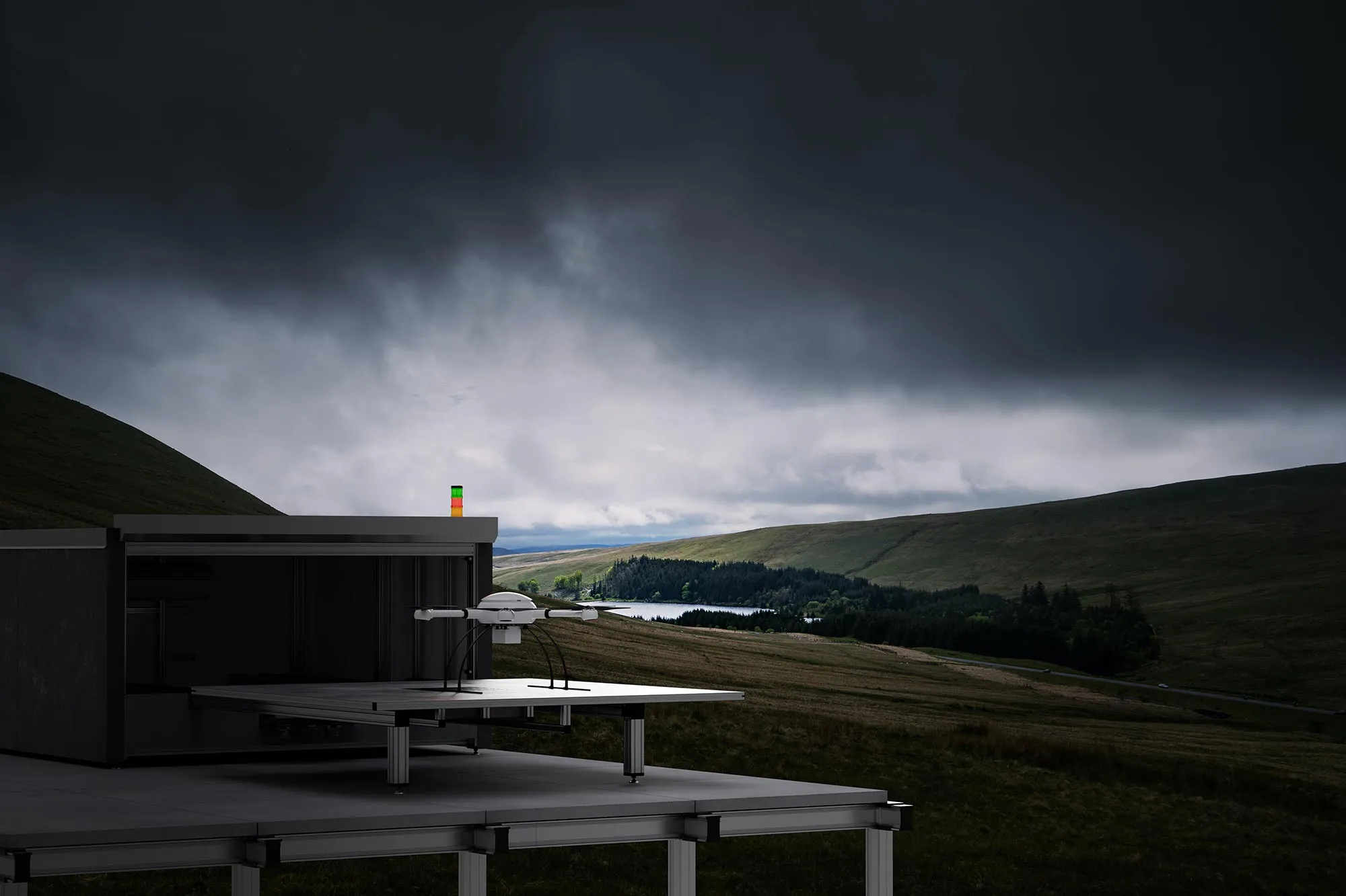
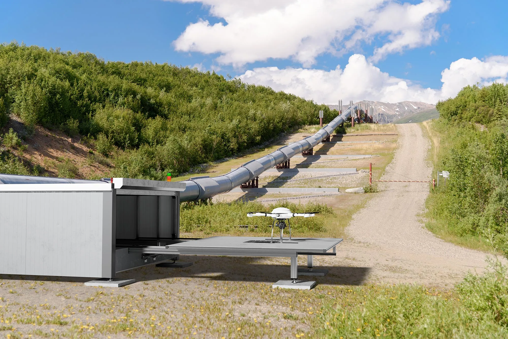
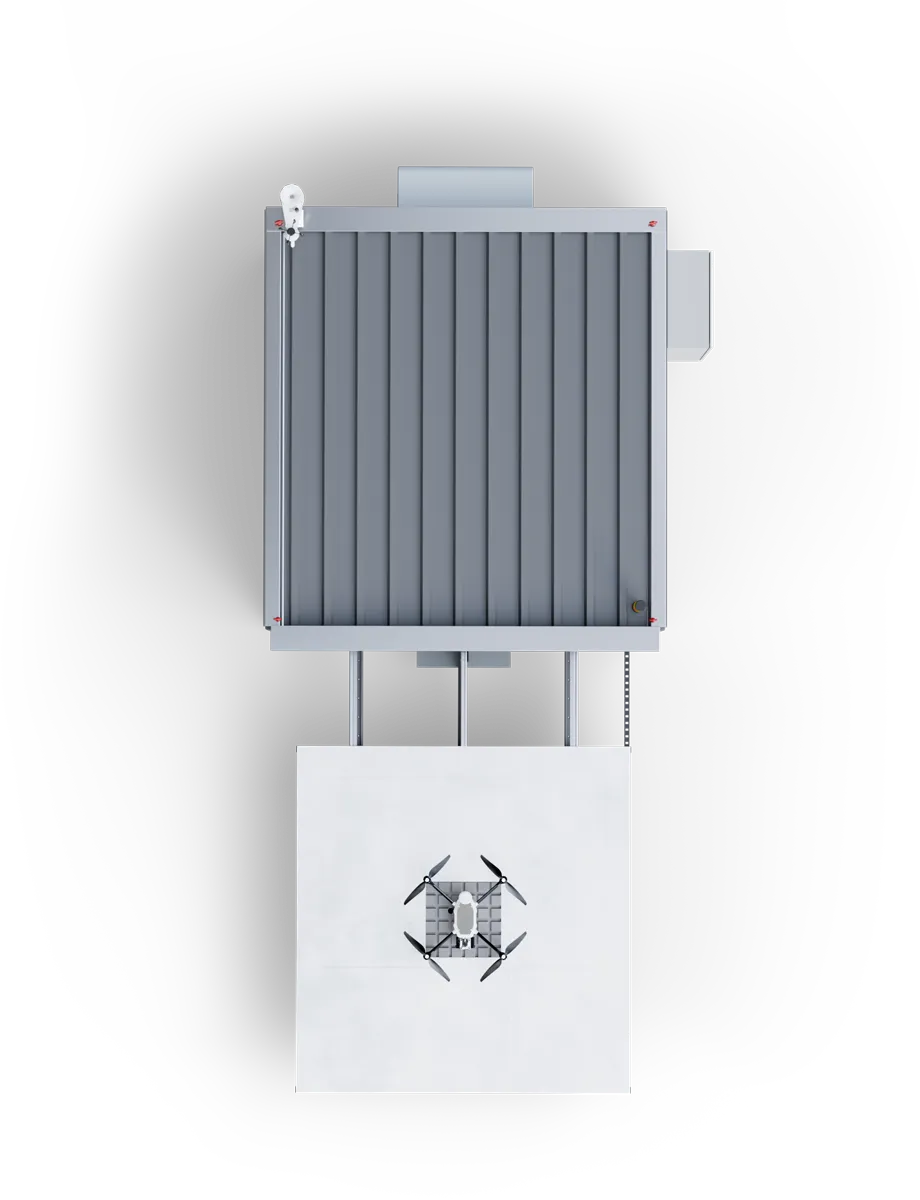
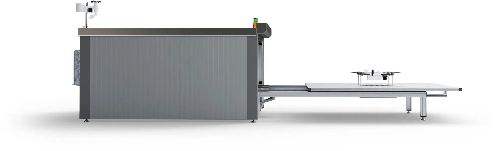
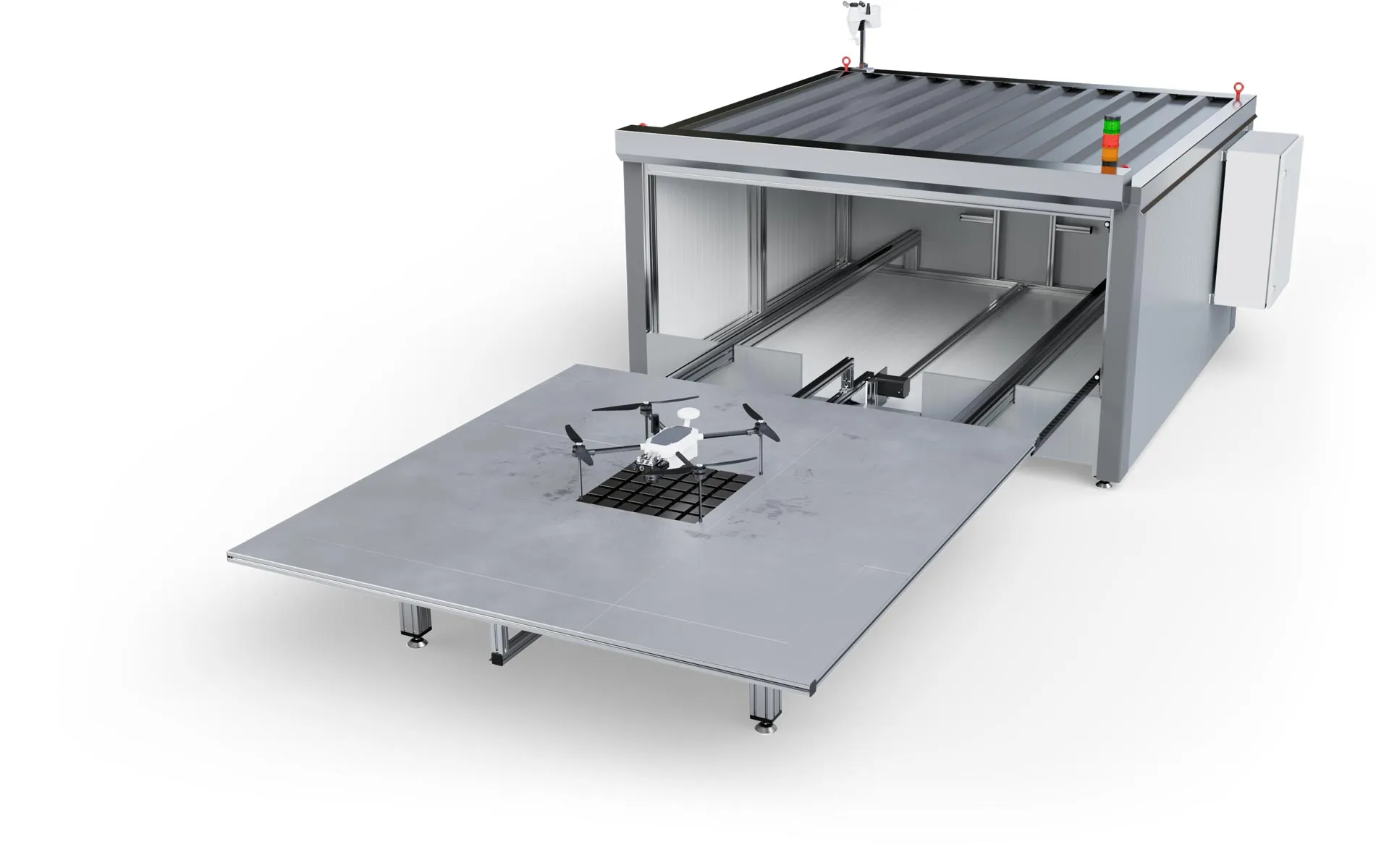
This hangar drone package for mapping tasks offers automated missions with the powerful Zelos Mapper drone out of the safe EB-DronePort.

In the protective EB-DronePort, the Zelos drone is well kept and ready to fly at any time and in almost any weather. The integrated weather station ensures safe operation and intuitive mission control can be done remotely.

Robust design for smooth operation

The EB-DronePort is made of robust sandwich panels that insulate well and support the hangar's air conditioning. A solid roll-up door closes and opens the hangar. On the movable take-off and landing surface, the drone is precisely aligned via a positioning device and can thus be recharged.

Icon: Protective shield with
40 mm
Insulation
Icon: Landing site with letter
AutoLand
Sensor assisted charging
Exabotix DronePort LiDAR hangar installed in vast uninhabited landscape. The hangar platform has moved out to accommodate the just-landed Mercury drone after its survey flight in time for the approaching storm.

High security due to integrated weather station

The EB-DronePort's built-in weather station ensures safe operation, as the drone will only take off when the weather is stable and safe for flight. The EB-DronePort's optional high-performance air conditioning allows flights in temperatures ranging from -20 to +40 °Celsius.

Icon: Wind
MeteoSafe
Weather station
Icon: Thermometer
-20 to +40 °C
Optional air conditioning
Air-conditioned Exabotix DronePort LiDAR hangar installed in uninhabited snowy landscape. The hangar platform is extended to launch the next automated survey flight of a Mercury drone.

Fully automatic remote operation thanks to networking

A network connection gives you full control of the EB-DronePort and the drone at all times. The software to control the hangar and flight missions remotely is included in the package. Operation can run via the Exabotix server or via your own server.

Icon: LTE
PortMesh
Networking
Icon: LAN network
4G/5G/LAN
Remote operation

Autonomous and fail-safe processes

All operations are designed for safe and fully automatic remote operation. After a flight mission, the acquired data is automatically downloaded and available to you via the EB-DronePort's connectivity. The batteries are automatically recharged for the next mission.

Icon: Battery being charged
AutoCharge
Automatic charging or battery replacement

For which applications is this package suitable?

From the safety of the EB-DronePort, this package lets you tackle demanding surveying and volume calculation tasks, for example. The lightweight drone offers a long flight time and the 42 megapixel camera with full-frame sensor delivers sharp images that are located with high precision thanks to the multiband RTK-GNSS receiver.

Exabotix DronePort Mapping Hangar view from above with Zelos Mapper drone for surveying tasks.

Surveying

Cartography

Corridor mapping

Mining

Structural and civil engineering

Volume calculation

DronePort Mapping Components

Icon: Landing site with letter
EB-DronePort
Safe and weatherproof home port for your drone and base for executing automated flight missions.
Icon: Wind
Weather station
The integrated weather station tells you what the weather is like, ensuring safe flight operations.
Icon: LAN network
LAN
The data obtained is automatically downloaded after the flight and is then available via the network.
Icon: Battery being charged
Recharge
The batteries are charged automatically, which ensures the greatest possible readiness of the system for flight.
Icon: Signal strength
Remote control
The package includes the software to control the flight missions remotely and to operate the hangar.
Icon: Quadrocopter
Quadrocopter
The Zelos drone has four drive units and a compact housing. The drone is quickly ready for use because it can be transported fully assembled and it offers a long flight time due to its light weight.
Icon: Battery, three quarters full
Battery
A powerful LiPo flight battery with 16,000 mAh provides plenty of power for enduring missions. The battery can be replaced in just a few steps, so even extensive surveying projects can be carried out without any problems.
Icon: Digialization
42 MP camera
The Sony RX1 R II is a professional compact camera with a full-frame sensor. The lens has a focal length of 35 mm. The camera is powered via the drone.
Icon: Iris diaphragm
Camera control
All essential camera settings, such as aperture, ISO or exposure correction, can be made via the remote control during the flight - you are always in full control.
Icon: Battery being charged
Charger
This fast charger lives up to its name: Two batteries can be fully charged simultaneously within 45 minutes.
Icon: Photo and magnifying glass
High accuracy
The system achieves very high accuracy: via a multiband RTK-GNSS receiver, the collected data is corrected and provides high precision with deviations in the millimeter range.
Icon: LTE
LTE module
The system achieves very high accuracy: via a multiband RTK-GNSS receiver, the collected data is corrected and provides high precision with deviations in the millimeter range.

Cost?

This EB-DronePort mapping with the Zelos Mapper has a lot to offer: Automatic flight missions, full remote control, automatic data retrieval and battery charging. With some options, you can tailor this package even better to your needs. We will be happy to explain the advantages of this package to you individually - just contact us.