Solutions for measurement, inspection and documentation

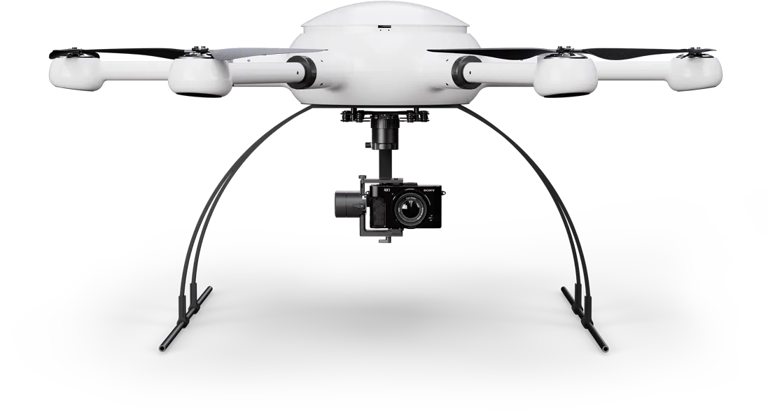
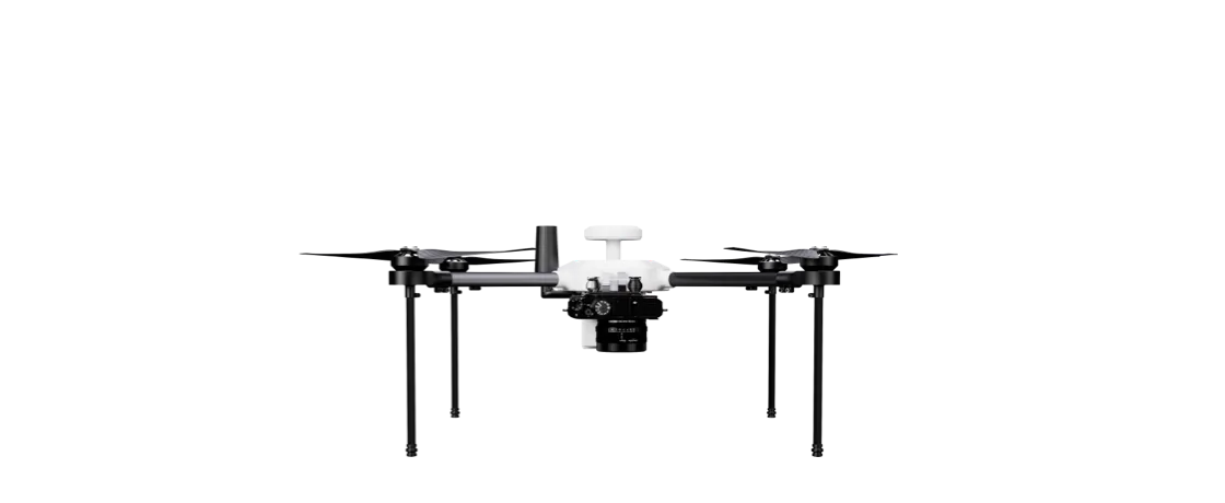
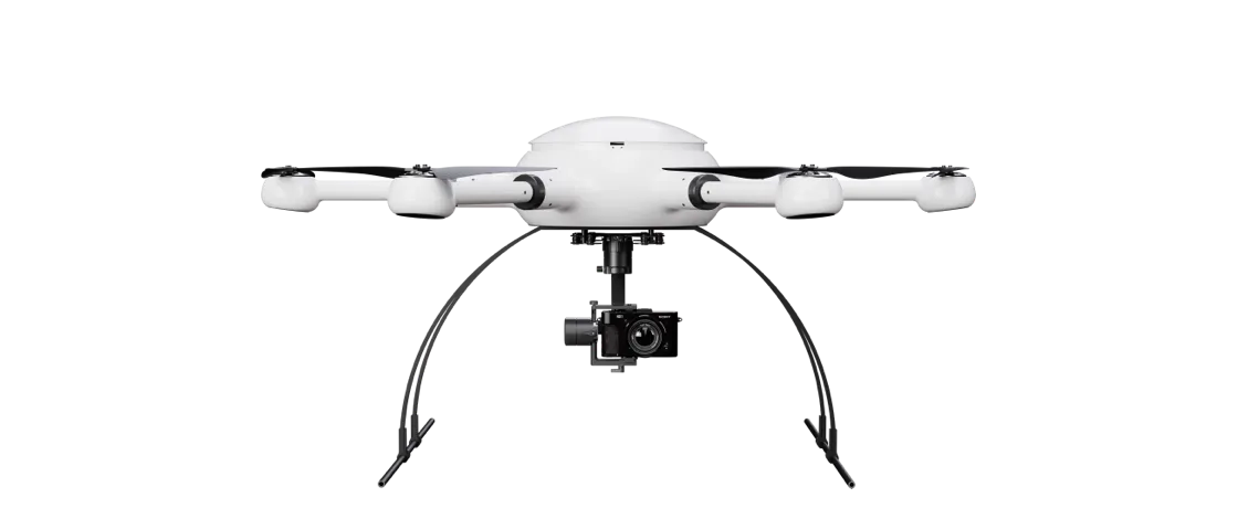
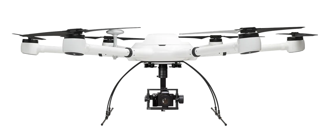
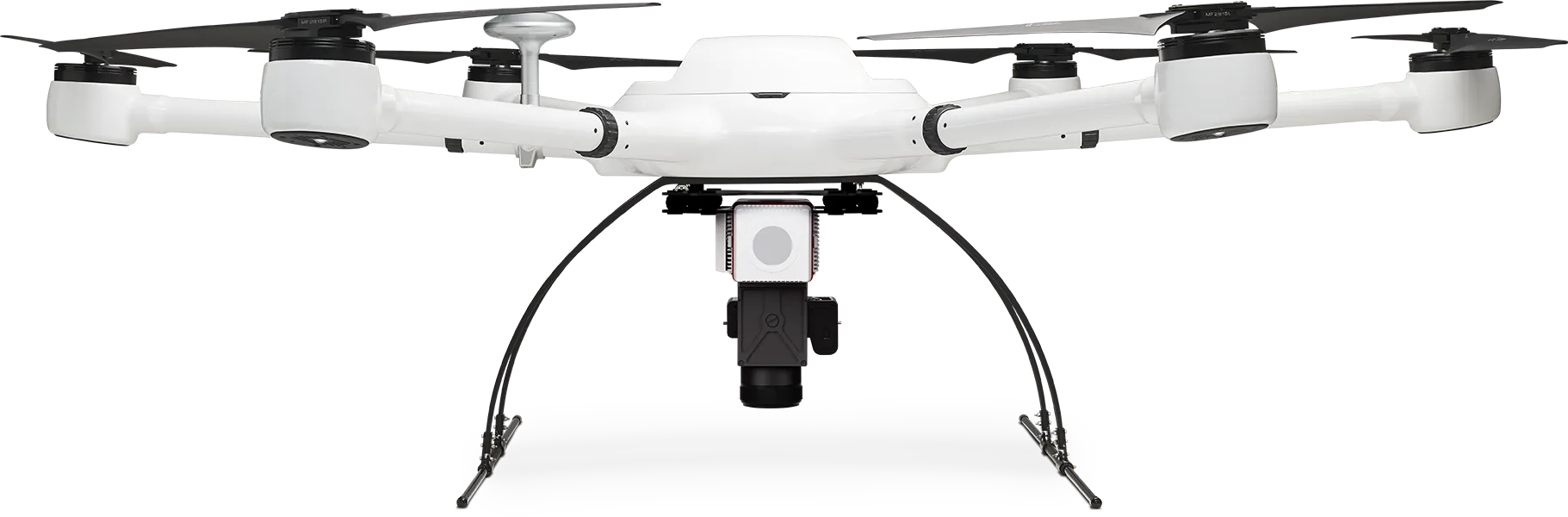
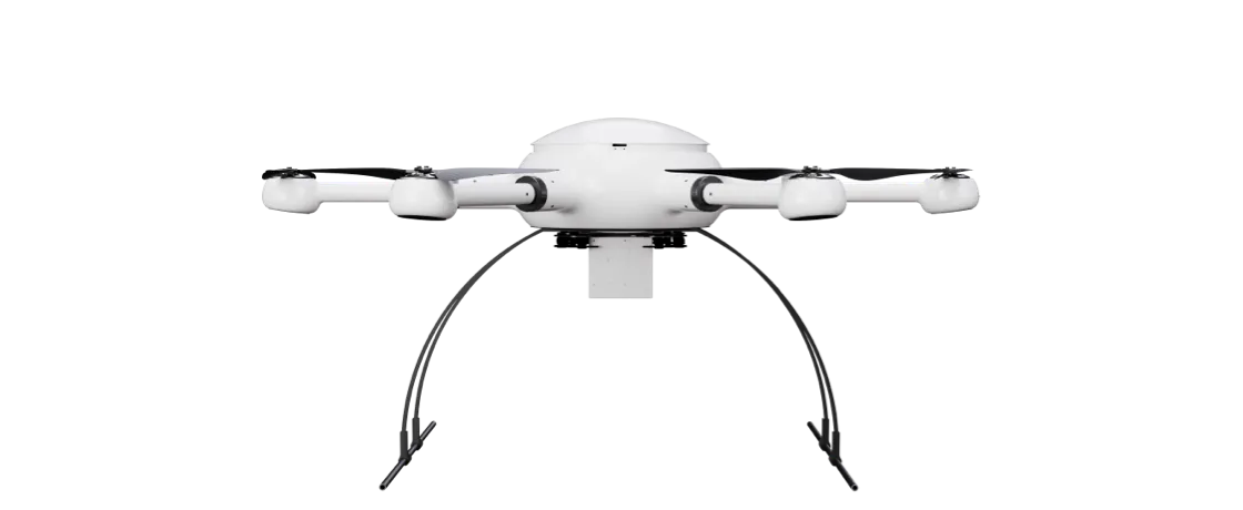
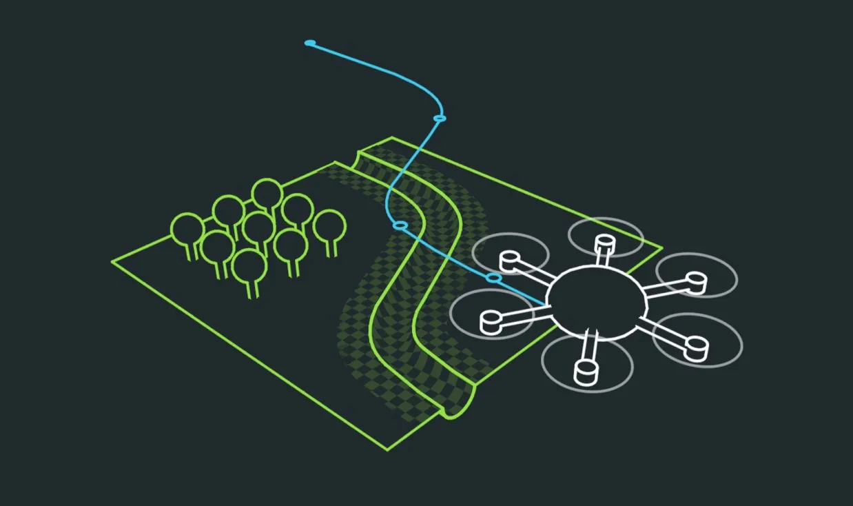
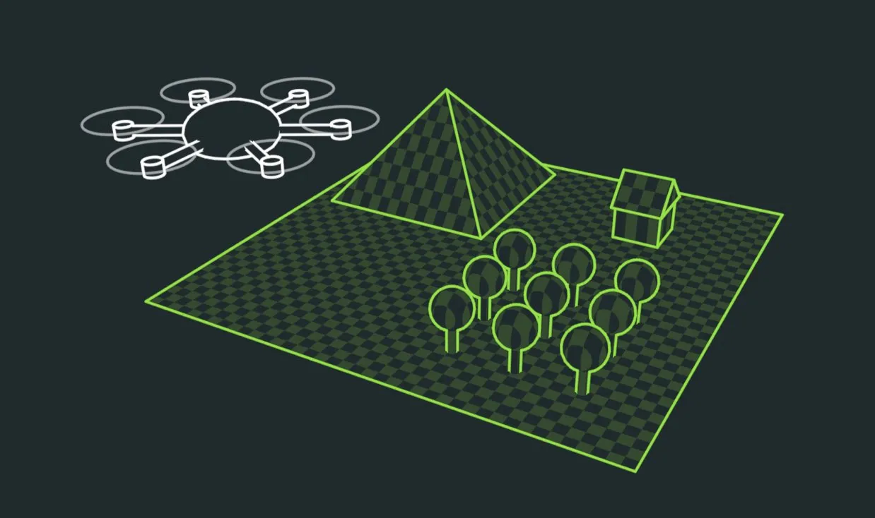
Faster and more effective:
Surveying from the air

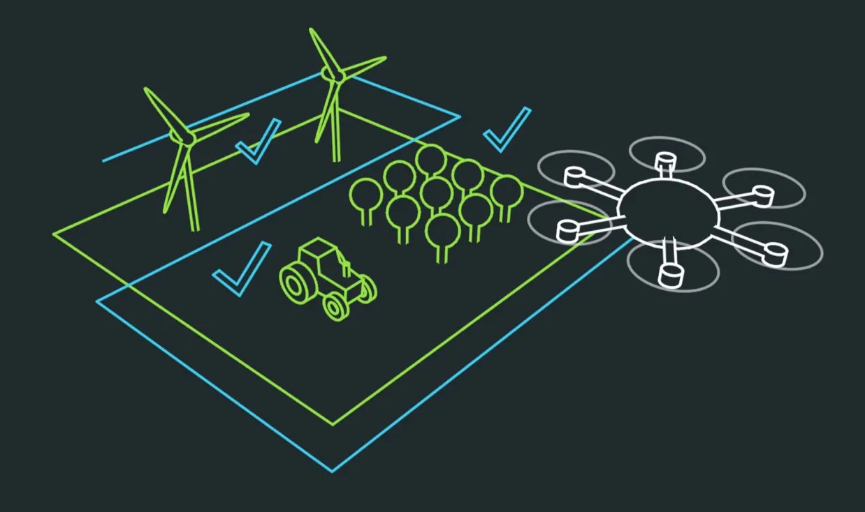
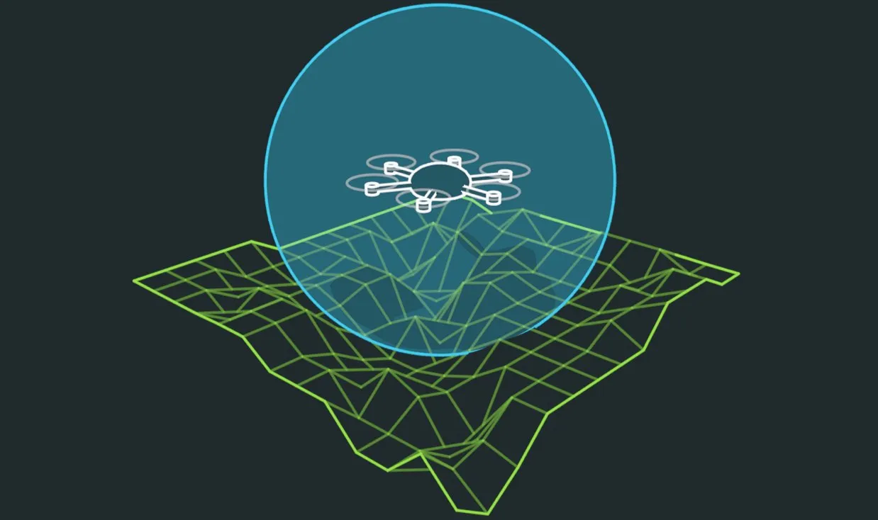
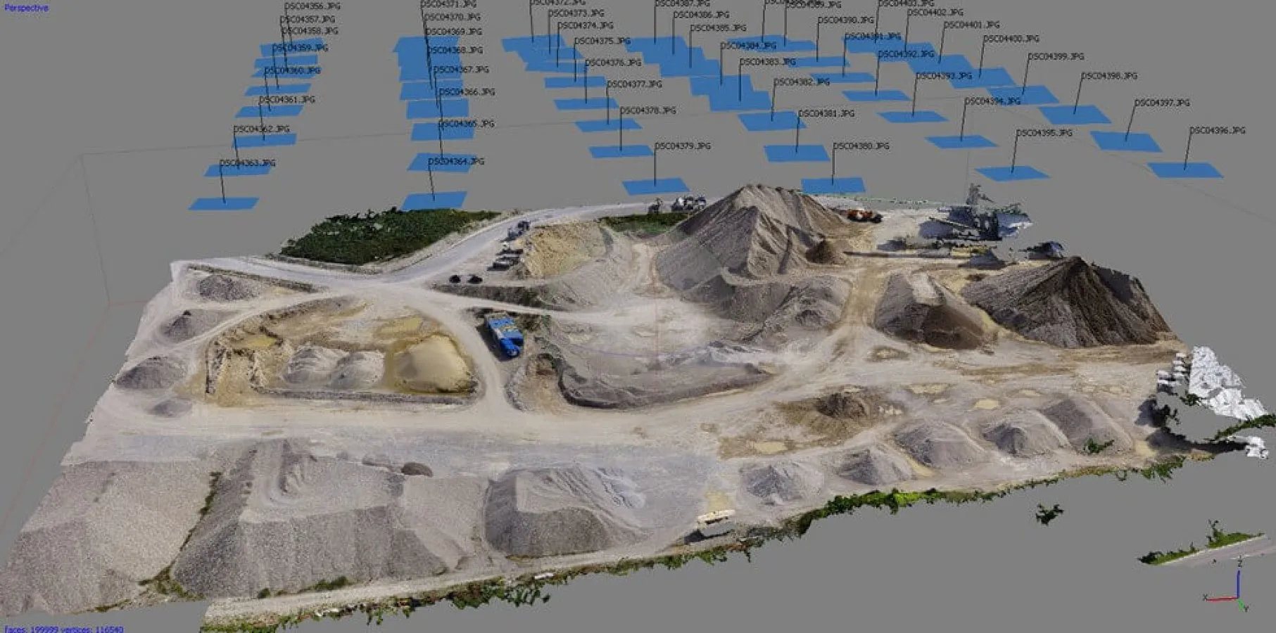
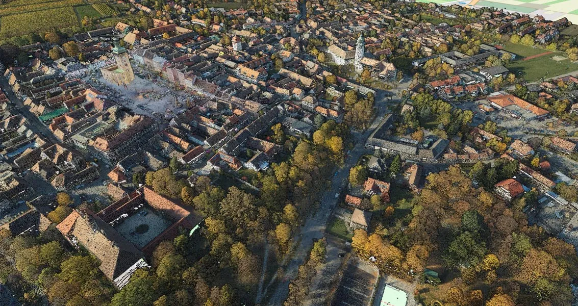
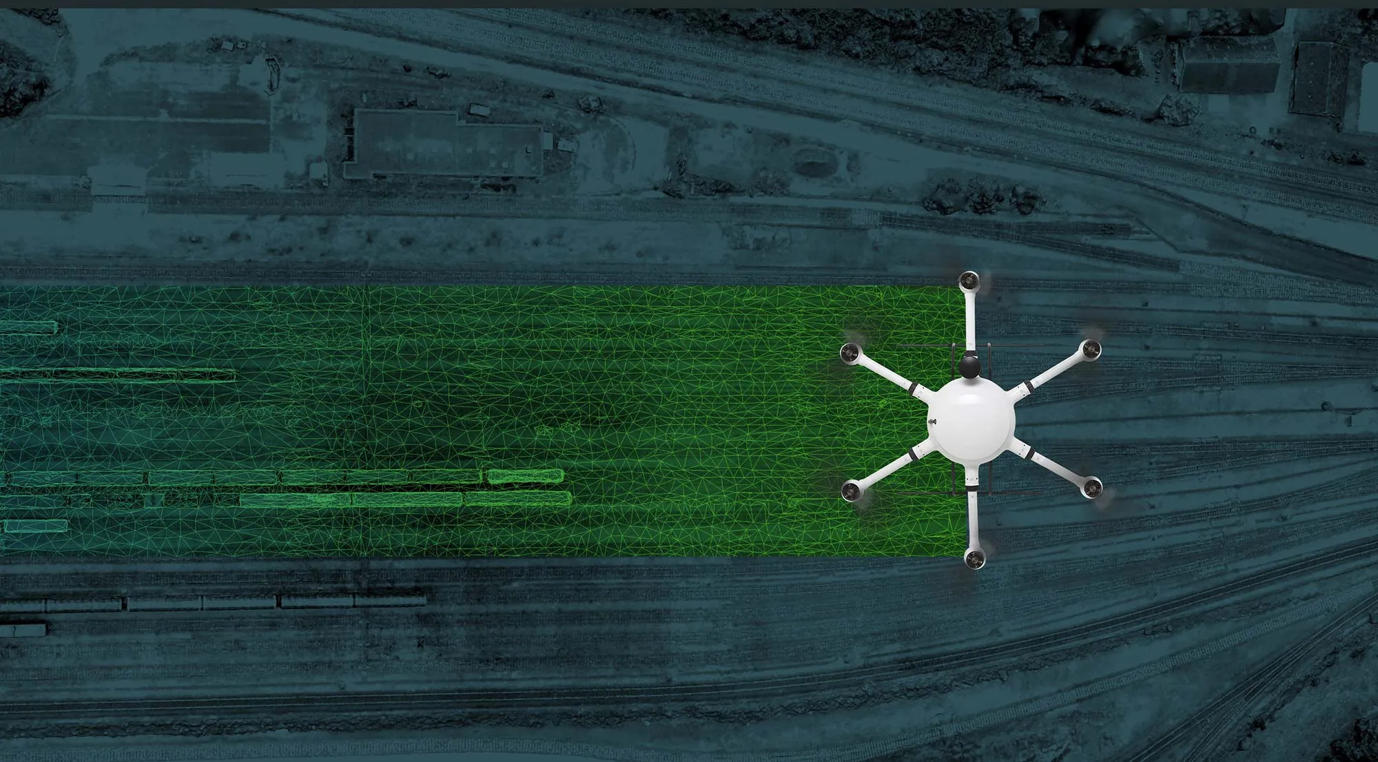
Modern drone systems are clearly superior to conventional surveying technology: They fly over large areas within a very short time - even in terrain that is difficult to access, they accelerate data acquisition and offer the highest precision in surveying and creating terrain models.

Exabotix Mercury Mapper Industrial drone front view with camera and gimbal for surveying and photogrammetry tasks.

Photogrammetry solutions

Photogrammetry is a non-contact and mobile method for object recording. With the help of high-resolution photographs, a two- or three-dimensional georeferenced documentation with a high degree of detail is created.

Exabotix Zelos Mapper Industrial drone front view with camera for surveying tasks.
Ideal entry

Zelos Mapper

Covers large areas and is a true price/performance champion for mapping projects thanks to full-frame camera.

Learn more
Exabotix Mercury Mapper Industrial drone front view with camera and gimbal for surveying and photogrammetry tasks.
Versatile

Mercury Mapper

High payload and aGimbael make this solution a versatile all-rounder for surveying tasks and 3D photogrammetry

Learn more
Exabotix Atlas Mapper Industrial drone front view with camera and gimbal for surveying and photogrammetry tasks.
Powerful

Atlas Mapper

High payload, stable flight attitude and very good camera resolution with interchangeable lenses: this system leaves nothing to be desired.

Learn more
Exabotix Atlas LiDAR Industrial drone front view with combined LiDAR scanner and camera for accurate true color 3D scanning and mapping tasks.

3D laser scanners - LiDAR systems

LiDAR systems emit laser pulses and detect the reflected light - the distance is calculated from the light travel time. High-resolution point clouds and three-dimensional object images are created as the basis for the most accurate surveys.

Exabotix Zelos LiDAR Industrial drone front view with LiDAR scanner for precise 3D scanning and surveying tasks.
Ideal entry

Zelos LiDAR

The high accuracy of the lightweight LiDAR scanner makes this package a price-performance tip for surveying projects.

Learn more
Exabotix Mercury LiDAR Industrial drone front view with LiDAR scanner for precise 3D scanning and surveying tasks.
Versatile

Mercury LiDAR

For advanced users: with an accuracy of 2cm, the LiDAR scanner of this solution together with the integrated 24MP camera provides colored point clouds.

Learn more
Exabotix Atlas LiDAR Industrial drone front view with combined LiDAR scanner and camera for accurate true color 3D scanning and mapping tasks.
Powerful

Atlas LiDAR

Precisely: a long-range 360° LiDAR scanner combined with a fast APS-C camera ensure precise results with an accuracy of up to one centimeter.

Learn more

Many advantages from surveying with drones

Illustration: Drone automatically surveys a larger area.
Icon: Stopwatch

Speed: more data in less time

In the shortest possible time, a drone flies over a large area and delivers precise data. You determine the flight area and the measurement parameters in advance, and the drone automatically flies the previously planned route. Compared to conventional surveying, drones work much more efficiently, save a lot of time and deliver highly accurate georeferenced data.

Illustration: Drone precisely measures the topography of a riverbed using corridor mapping.
Icon: Photo and magnifying glass

Precision: more accurate data with more efficiency

Drone technology offers a highly accurate and easily accessible database for aerial surveys, mapping and other geoinformation. The flight altitude - known as the ground sampling distance - determines the desired amount of data. The use of ground control points further increases the accuracy. High-precision sensors and modern software make the work of geodata professionals easier.

Illustration: Large areas, buildings and facilities can be quickly digitized using a drone.
Icon: Digialization

Digitization: fast and lossless processing

After the flight, the captured data together with the GPS information from the drone are transferred to post-processing software. The measurement data are highly accurate and, depending on the technology, are available as orthophotos, 3D images or point clouds. With the help of various software solutions, the results can be further processed professionally.

Illustration: By means of different payloads, the drone can be used for different applications, such as large-scale plant inspection, precision farming or surveying.
Icon: two circular arrows rotating counterclockwise around a circle.

Flexibility: one drone, many applications

Depending on the requirements, the systems of the drone are configured individually. Within an application, each solution offers a lot of flexibility. If the requirements change, Exabotix can very quickly make adjustments to the configuration through its service and manufacturing on site in Germany. Thus, the drone remains a high-quality and professional working tool for a very long time.

Illustration: Drone automatically maintains a safe distance from terrain with irregular topography.
Icon: Protective shield with

Safety: cover rough terrain without risk

Thanks to automatic or semi-automatic flight operation, you work with the utmost safety. Even projects in hard-to-reach areas or in dangerous terrain are no problem. Sites can be safely surveyed during construction - workers and machines can continue working while the required data is collected.

Which package fits my projects?

You are unsure which aerial survey solution fits your task? We have put together packages that cover numerous different requirements. We will be happy to support you in selecting or putting together the service package that is right for you - from planning and flight to data processing, display and evaluation of the results.

Photogrammetry preview of a 3D visualization calculated from individual images of a drone survey flight.

Photogrammetry

Aerial photogrammetry allows surveying and mapping even without ground control points. The aerial image provides a very accurate 3D model, offers natural color reproduction and distortion-free representation of the surface and objects.

Visualization of a point cloud of a city captured by LiDAR scanner and drone.

LiDAR

The LiDAR (Light Detection and Ranging) scanner emits light pulses via laser beam and detects the corresponding echo. The system achieves the best possible measurement in terms of height accuracy and can also display surfaces very well. The very accurate point clouds allow precise and post-processable 3D models of landscape and objects to be created - resulting in digital twins, such as of quarries or radio towers.

Exabotix Zelos Mapper Industrial drone front view with camera for surveying tasks.

Zelos Mapper

Ideal entry
  • EB-Zelos drone
  • Sony RX1R II
  • EB Controller
  • Multiband RTK-GNSS
Icon: Weight
1 kg
Payload
Icon: Stopwatch
60 min
Flight time
Icon: Photo and magnifying glass
< 1 cm
Accuracy
Icon: Digialization
24 MP
Resolution
Learn more Configure now
Exabotix Mercury Mapper Industrial drone front view with camera and gimbal for surveying and photogrammetry tasks.

Mercury Mapper

Versatile
  • EB-Mercury drone
  • Sony RX1R II
  • Gimbal Gremsy Pixy U
  • EB Controller
  • Multiband RTK-GNSS
Icon: Weight
3,5 kg
Payload
Icon: Stopwatch
25 min
Flight time
Icon: Photo and magnifying glass
< 1 cm
Accuracy
Icon: Digialization
24 MP
Resolution
Learn more Configure now
Exabotix Atlas Mapper Industrial drone front view with camera and gimbal for surveying and photogrammetry tasks.

Atlas Mapper

Powerful
  • EB-Atlas drone
  • Sony A7R IV
  • Gimbal Gremsy T3
  • EB Controller
  • Multiband RTK-GNSS
Icon: Weight
13 kg
Payload
Icon: Stopwatch
25 min
Flight time
Icon: Photo and magnifying glass
< 1 cm
Accuracy
Icon: Digialization
61 MP
Resolution
Learn more Configure now
Exabotix Zelos LiDAR Industrial drone front view with LiDAR scanner for precise 3D scanning and surveying tasks.

Zelos LiDAR

Ideal entry
  • EB-Zelos drone
  • EB-LiDAR Scanning System
  • EB Controller
  • Multiband RTK-GNSS
Icon: Weight
1 kg
Payload
Icon: Stopwatch
40 min
Flight time
Icon: Photo and magnifying glass
2 cm
Accuracy
Icon: LiDAR scan area
70°
Field of view
Learn more Configure now
Exabotix Mercury LiDAR Industrial drone front view with LiDAR scanner for precise 3D scanning and surveying tasks.

Mercury LiDAR

Versatile
  • EB-Mercury drone
  • EB-LiDAR Scanning System PRO +C
  • 24 MPCamera
  • EB Controller
  • Multiband RTK-GNSS
Icon: Weight
3,5 kg
Payload
Icon: Stopwatch
20 min
Flight time
Icon: Photo and magnifying glass
2 cm
Accuracy
Icon: LiDAR scan area
70°
Field of view
Learn more Configure now
Exabotix Atlas LiDAR Industrial drone front view with combined LiDAR scanner and camera for accurate true color 3D scanning and mapping tasks.

Atlas LiDAR

Powerful
  • EB-Atlas drone
  • RIEGL miniVUX-3UAV
  • Applanix APX-15 IMU/GNSS
  • Sony A6000
  • Gimbal Gremsy T3
  • EB Controller
  • Multiband RTK-GNSS
Icon: Weight
13 kg
Payload
Icon: Stopwatch
25 min
Flight time
Icon: Photo and magnifying glass
1 cm
Accuracy
Icon: LiDAR scan area
360°
Field of view
Learn more Configure now
"Field survey work shrinks from several days to a few hours thanks to Exabotix."
Jürgen W., Surveyor near Berlin
"Exabotix's consulting helped us get exactly the solution we needed to get our projects done efficiently."
Kathrin P., project manager of a surveying office in northern Germany

Use our experience for your solution!

Arrange a no-obligation consultation for your surveying project? Together we will find out what you need and how you can best and most cost-effectively implement your project.

Trust in systems made in Germany and in professional service - at Exabotix you get all services from one source. What should your solution be able to do?