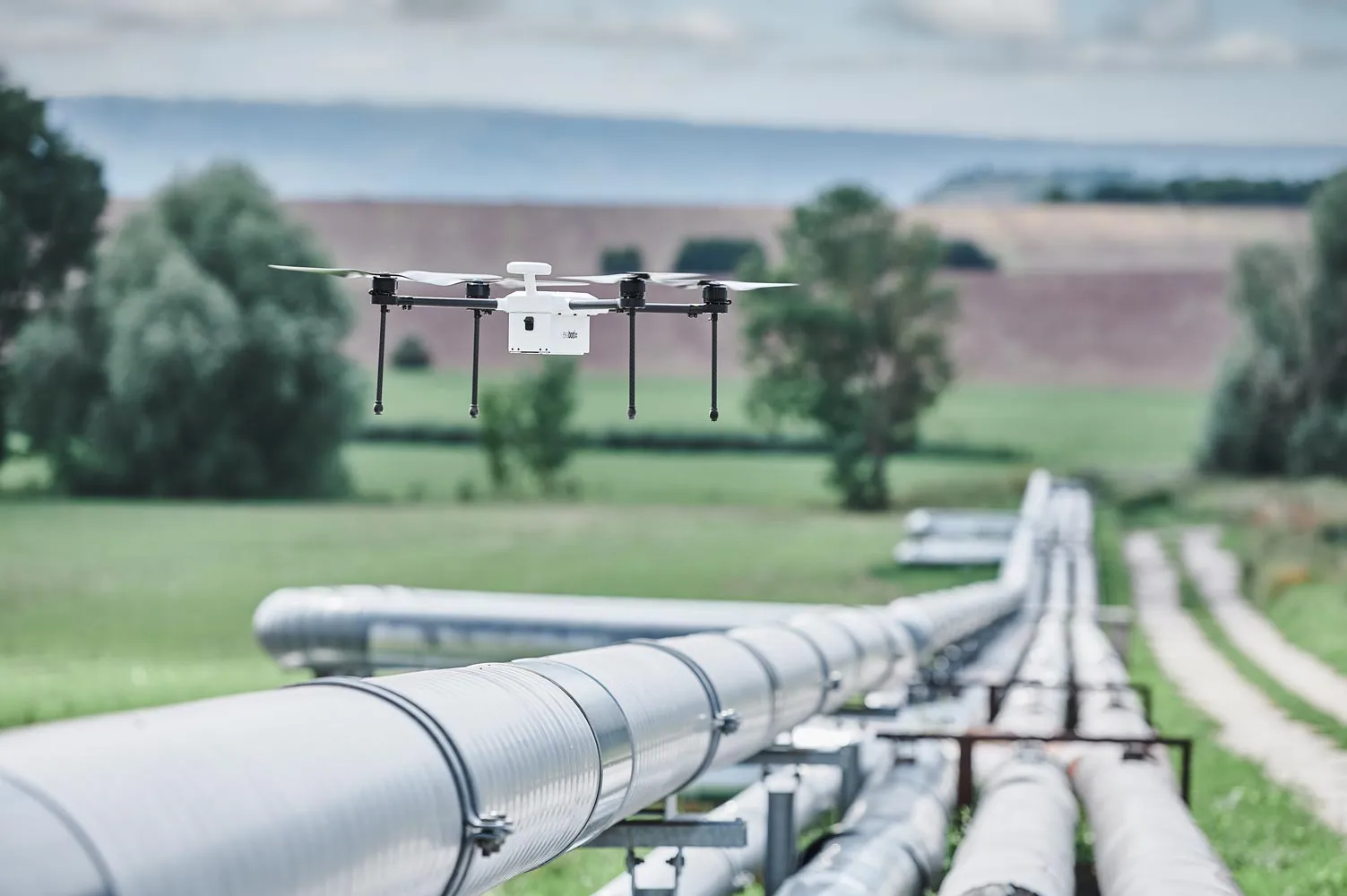
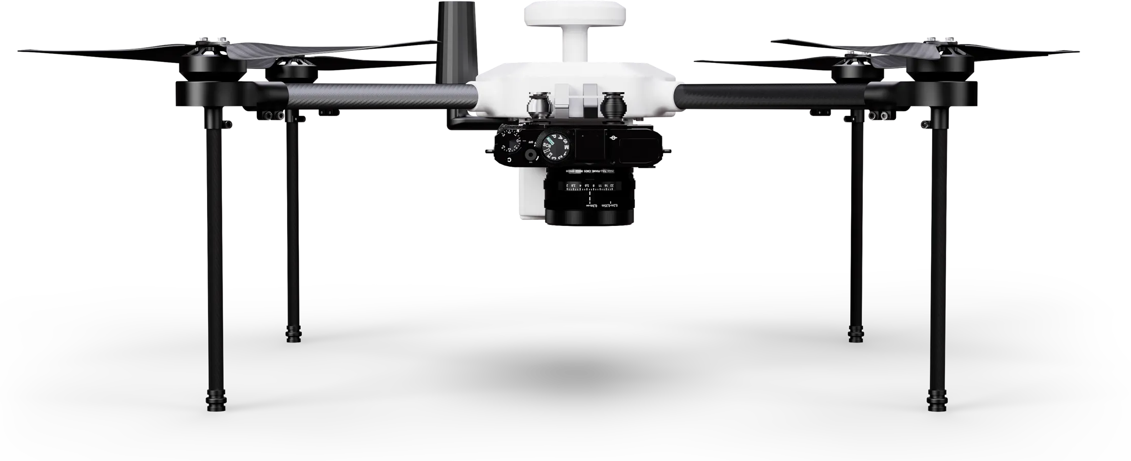
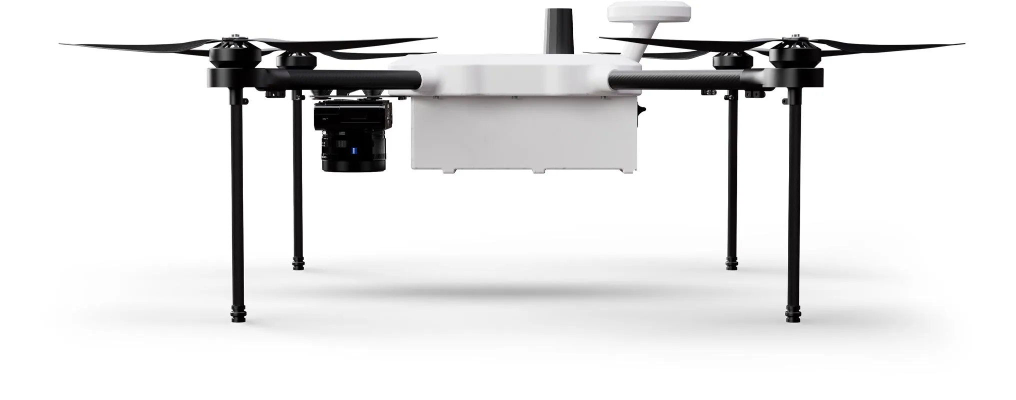
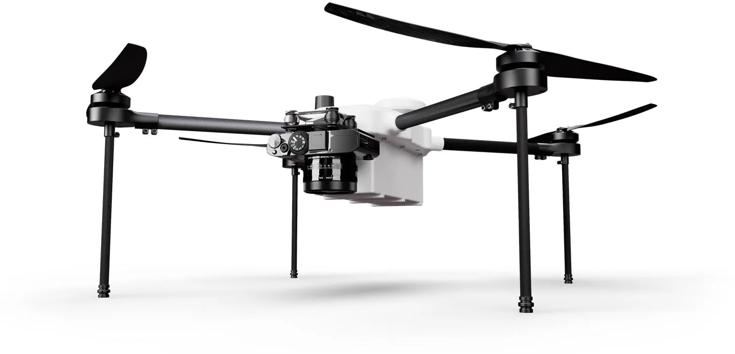
Icon: Weight
1 kg
max payload
Icon: Stopwatch
40 min
Flight time
Icon: Photo and magnifying glass
< 1 cm
Accuracy
Icon: Digialization
42 MP
Image resolution
Zelos Mapper

The compact and flexible surveying specialist

This drone surveying solution is quickly ready for use because the quadrocopter can be transported fully assembled thanks to its compact size. The system covers large areas and is a real price-performance champion for mapping projects due to the lightweight full-frame camera.

Light weight for more range 

The light weight of the Zelos Mappers makes this package so powerful. With the integrated 42 MP camera, you can stay in the air for up to 60 minutes per battery and depending on weather conditions. For extensive projects, this surveying solution is best suited.

Icon: Stopwatch
40 min
Flight time
Icon: Digialization
42 MP
Resolution
Vast landscape, through which a path winds, in the sunset.

Simple and intuitive flight planning

Flight planning made easy: Set the framework for your survey project on your PC or on the remote control screen and your drone will perform the flight automatically. If desired, you can intervene in the control via the EB controllers and steer by hand.

Icon: Waypoint for mission planning
PC+RC
Flight planning
Icon: automated drone flight
AutoFlight
Automatic missions
Aerial view of a forest area with waypoints for automated drone flight.

Handy and robust remote control

With the portable EB controller with a high-resolution 5.5 inch monitor, you always have full flight control. A range of up to 4 kilometers gives you plenty of scope, just like the built-in 4950 mAh lithium polymer battery for up to 5 hours of runtime.

Icon: Display size
5.5 inch
RC display
Icon: Battery being charged
5 h
Battery life
Exabotix employee controls drone in the distance over a pipeline running through an uninhabited landscape.

LiPo power for enduring missions

The powerful flight battery provides good endurance and excellent flight performance. With 16,000 mAh and 22.2 volts, it is a real powerhouse. The battery is located inside, so it is protected from the weather, can be replaced in a few simple steps and fully recharged in just 45 minutes.

Icon: Battery, three quarters full
16.000
mAh capacity
Icon: Stopwatch
45 min
Loading time
Zelos drone hovers over a pipeline running through an uninhabited landscape.

For which applications is this package suitable?

You want to fly long in one piece? This package shines with compact dimensions, making it easily transportable and offering a long flight time thanks to its low weight. The 42 megapixel camera with full-format sensor ensures sharp images that are located with high precision thanks to the multiband RTK-GNSS receiver - the best prerequisites for demanding mapping tasks.

Exabotix Zelos Mapper Industrial drone front view with camera for surveying tasks.

Surveying

Cartography

Corridor mapping

Mining

Structural and civil engineering

Volume calculation

Zelos Mapper Components

Icon: Quadrocopter
Quadrocopter
The Zelos drone has four drive units and a compact housing. The drone is quickly ready for use because it can be transported fully assembled and it offers a long flight time due to its light weight.
Icon: Battery, three quarters full
Battery
A powerful LiPo flight battery with 16,000 mAh provides plenty of power for enduring missions. The battery can be replaced in just a few steps, so even extensive surveying projects can be carried out without any problems.
Icon: Battery being charged
Charger
This fast charger lives up to its name: Two batteries can be fully charged simultaneously within 45 minutes.
Icon: Transport box
Transport box
In the robust and impact-resistant transport box, the drone system is well protected and practical to transport at any time.
Icon: Digialization
42 MP camera
The Sony RX1R II is a professional compact camera with a full-frame sensor. The lens has a focal length of 35 mm. The camera is powered via the drone.
Icon: Iris diaphragm
Camera control
All essential camera settings, such as aperture, ISO or exposure correction, can be made via the remote control during the flight - you are always in full control.
Icon: Waypoint for mission planning
Image coordinates
During the flight, the exact geo-coordinates are assigned to each captured image and stored in the Exif metadata of the image. After the flight, the georeferenced data is directly available for further processing - without time-consuming matching.
Icon: Photo and magnifying glass
High accuracy
The system achieves very high accuracy: via a multiband RTK-GNSS receiver, the collected data is corrected and provides high precision with deviations in the millimeter range.

Cost?

This package is a real price-performance miracle: long flight time, powerful camera and intuitive project planning as well as easy further processing of the high-precision data. The Zelos Mapper is your professional surveying tool. We will be happy to explain the advantages of this package to you individually - just contact us.